
Asset labeling
Ensure that infrastructure is clearly identified and that operational activities in the field are carried out efficiently
What are the benefits of entrusting us with the comprehensive asset labeling of your outdoor facilities?
We fully understand our clients’ needs, which is why we approach every project involving the marking of operational assets (such as cable joints, transformer stations, poles and power supply points) on a case-by-case basis and in accordance with applicable standards. We provide full technical support at every stage, from the analyses of field data, through verification of compliance with GIS/SCADA systems, to the durable and legible marking of facilities. Our activities provide tangible support for the safety and efficient operation of the power grid.
By choosing to engage in cooperation with us, you can count on:
full labelling of facilities with identification plates in accordance with the Client’s standard,
the integration of signage with GIS and SCADA systems to ensure consistency between field and system data,
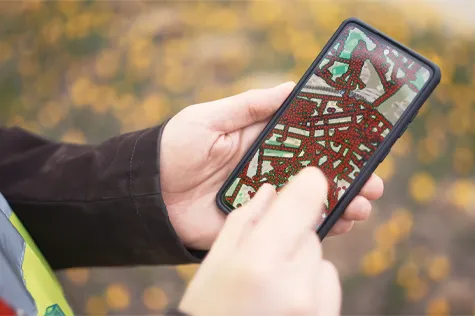
quick and accurate search for locations by scanning codes in a mobile app (e.g. QR codes),
unambiguous identification of the infrastructure in operation, which reduces errors and misunderstandings during work,
photographic documentation of each marked object,
recording geographical coordinates and object attributes directly in the field application,
accurate as-built reports/maps and a complete set of data ready for import into GIS systems.
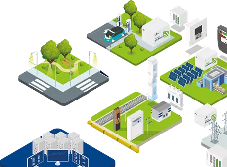
Sectors that most frequently commission asset labeling

Clear labelling of junctions, stations and infrastructure components is crucial for ensuring safety, the correct operation of processes and reducing response times to incidents. The implementation of a systematic labelling system, combined with a mobile app, enables objects to be located quickly, eliminates identification errors and facilitates more efficient cooperation between field teams and dispatchers.

Ensure unambiguous identification of infrastructure and full site–GIS–SCADA integration
Take advantage of our professional signage services
Ensure data consistency and full traceability of network devices in the field
Why is signage so important?
Because an unmarked facility does not exist in operational terms, even if it appears in the GIS – the lack of a clear reference to it in the field hinders every operational activity: from inspections and measurements, through fault location, to handling reports and investment activities.

Asset labeling in the field – including junctions, transformer stations and other infrastructure components – is a key element of digital network operations. The installation of identification tags (e.g. QR codes) and full integration with GIS and SCADA systems enable immediate access to information about the asset, its connections, technical condition and operational history.
As a result of tagging, assets gain a unique field representation, which significantly reduces the time taken to locate and resolve faults. Field teams can quickly locate the correct infrastructure point by scanning a QR code and retrieve data on the circuit or substation.
As part of these services, we offer the following, amongst other things:
design and installation of identification plates in accordance with the Client’s guidelines,
scanning and registering objects via mobile apps,
standardisation of field object identifiers with entries in GIS and SCADA,
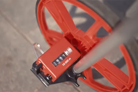
acquisition of GPS coordinates with field-level accuracy,
preparation of photographic documentation of the object and its surroundings,
adding operational notes and attachments to object records,
synchronising data with the central system and updating facility records.
All field data – photographs, coordinates, notes, reports – is recorded in the mobile app and can be synchronised with the Client’s systems, ensuring full network data consistency.
How does the process of marking objects work?
First, we identify the objects requiring marking and verify their consistency with the data in the GIS. We then perform the installation of identification plates and register codes, such as QR codes. Each object is scanned, described, photographed and recorded in the mobile app along with its precise GPS location. In the next step, we synchronise the data, linking field information with the central system. The result is a complete, consistent and up-to-date database of objects, ready for immediate use by field teams, dispatchers and SCADA system operators. Finally, we provide the Client with a full set of documentation – lists of facilities, overview maps, photographs, sets of coordinates and files for import into GIS.
Services you might be interested in


Frequently Asked Questions
Yes – in accordance with best operational practices and safety requirements, the network operator must ensure that assets are clearly identified so that they can be properly maintained, monitored and managed in the event of incidents in the field. A lack of signage significantly increases the risk of misidentifying an asset and prolongs response times.
Yes – objects are identified by scanning the QR codes on the information plaques. The app automatically retrieves data from the GIS, highlights the object on the map and displays the plaque with technical data.
Yes – we provide photographic documentation, GPS coordinates, lists of features, reports and files for import into GIS, in accordance with the Client’s standards.
Ensure the consistency of GIS data and the reliable traceability of objects in the field
Please contact us to arrange comprehensive infrastructure marking